
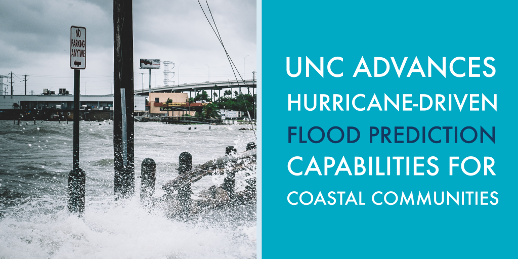
On September 14, 2018, Hurricane Florence made landfall in the Wrightsville Beach area of coastal North Carolina. While the storm was a category 1, it caused catastrophic flooding throughout much of the state. The record amount of rain from the system combined with an already saturated soil. Rivers overflowed their banks, storm surge inundated coastal areas, and the water had nowhere to go. It was a rare compound flooding scenario that will be studied and remembered for a long time.
It is difficult to model compound flooding – fluvial (river), pluvial (surface flooding unrelated to rivers), and oceanic storm surge interaction – impacts, but this scenario is faced annually by communities in the path of tropical and extratropical storm systems. Unfortunately, the difficulty of modeling and understanding these events impedes already difficult hurricane decision-making, leaving countless communities at increased risk, and there is evidence that these compound flooding events may occur more frequently in the future (e.g., Wahl, T., et al. “Increasing risk of compound flooding from storm surge and rainfall for major US cities.” Nature Climate Change 5.12 (2015): 1093-1097.). But a new modeling approach for river representation in the widely used coastal model ADCIRC may help change that, providing predictions and insights to the decision-makers working to keep their communities safe during storm-related flood events.
The Renaissance Computing Institute (RENCI), University of North Carolina (UNC) Center for Natural Hazards Resilience, and Institute of Marine Sciences (IMS) at UNC-Chapel Hill, combined efforts under a grant from the National Oceanic and Atmospheric Administration (NOAA) to develop a better modeling approach for the compound flooding caused by these interconnected water systems. The resulting model advancement will help scientists represent river channel size variations and provide better insights into interactions between river channels and floodplains.
Current Models:
There are several models used to understand and predict coastal inundation scenarios, but two models are primarily used to understand flooding:
- ADCIRC is developed by a consortium of researchers in academia, government, and industry, with activities centered and coordinated at both UNC-Chapel Hill and Notre Dame. It is the most widely used storm surge modeling and analysis platform. In fact, FEMA uses the model for coastal flood insurance studies, defining storm surge levels for coastal insurance rates. However, the standard trapezoidal river channel representation used in ADCIRC only accounts for structures down to 30 m, with smaller structures (small rivers, man-made waterways, inlets, estuaries, etc.) creating a more burdensome computation. This creates inaccuracies when modeling compound flood events.
- HEC-RAS, a fluvial modeling system developed by the Army Corps of Engineers, accurately models river systems and has been the primary system used for real-time prediction of river flow and stage by the NOAA River Forecast Centers. It was originally developed as a model for inland river systems, where coastal waters do not reach.
As a result, we currently have two unique and independently accurate models, one for storm surge flooding, and one for fluvial systems, but neither adequately accounts for impacts captured by the other. This means communities that fall into both flood risk zones are left outside our current ability to model and understand their unique circumstances.
Modeling Compound Flooding
The team’s new riverine feature in ADCIRC, led by Dr. Shintaro Bunya (a research scientist with UNC-Chapel Hill’s IMS and DHS-funded Coastal Resilience Center) and Prof. Rick Luettich (Earth, Marine, and Environmental Sciences (EMES) faculty member, Director of UNC-Chapel Hill’s IMS, and principal investigator of the Coastal Resilience Center), represents fluvial channels and man-made waterways using elongated, one-dimensional elements in the channel direction. The depth of the river and the height of the river bank are then specified at the same location. Previously not possible in ADCIRC, this “discontinuous” elevation permits a more accurate simulation of water flow and more easily accounts for smaller structures. The new river feature seamlessly fits into existing two-dimensional ADCIRC models and is as accurate at modeling fluvial flooding as HEC-RAS. The technique details and applications were recently published here.
Already, the model has proven its worth. The new river feature was demonstrated in a real-world application (see the figure below) using a large, ocean scale ADCIRC grid for detailed simulations along the North Carolina coastal region. The coastal river network, with about 200 m along channel resolution in the Neuse River, is represented by the narrow elements, detailed in insets A and B. The entire ADCIRC grid is shown in inset C. The orange-red colors show the predicted maximum water level contour in a Hurricane Florence (2018) simulation, and the plot in the upper right shows a comparison of observed versus predicted high water marks along the Neuse River. The agreement between observations and predictions is very high, indicating that this new approach to river channel representation in ADCIRC will be highly beneficial in predicting future flooding river flow conditions and their impacts on coastal flooding.
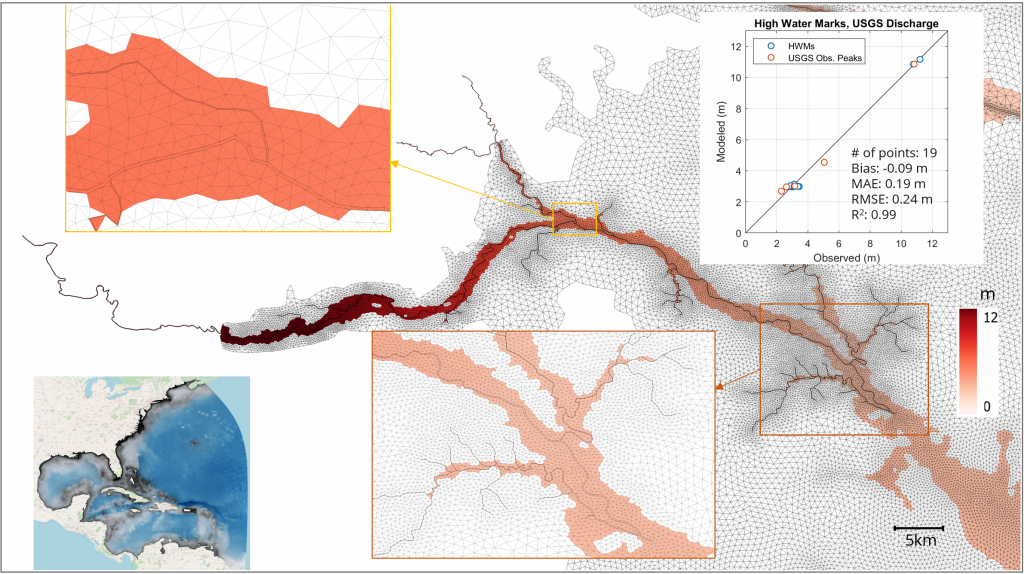
Figure. Real-world example of the new channel network feature in ADCIRC.
This new model has the potential to provide better predictions for communities where evacuation decisions can be the hardest to make, in the hope that North Carolina and other coastal states are less likely to be caught off guard by the flood risks in these compound flooding events.