ASHEVILLE, NC–RENCI at UNC Asheville and Asheville-Buncombe Technical Community College (A-B Tech) announce the third annual celebration of Geographic Information Systems (GIS) Day in Western North Carolina. The community drop-in event will be held from 11 a.m. to 1 p.m. Thursday, Nov. 12, at the RENCI at UNC Asheville Community Engagement Site, located in the Grove Arcade in downtown Asheville. The event is free and open to the public.
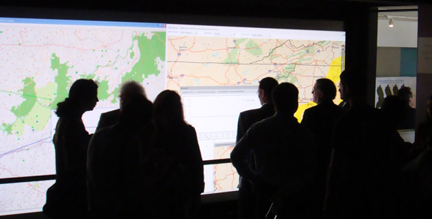
GIS Day provides an opportunity to see how geographic information systems work and how they are being used in local initiatives. Visitors will see a 16-foot visualization wall, an immersive GeoDome and 3-D visualizations in action as they learn about GIS projects such as map Asheville’s Priority Places, the newly released Urban Growth Model for the Asheville region, a multi-hazard risk analysis tool, GIS-based analysis of threats to eastern forests, flooding impacts and mitigation, and geospatial climate information viewers.
GIS professionals from local and regional organizations, including the City of Asheville, Buncombe County, the Land of Sky Regional Council of Governments, the Metropolitan Sewerage District of Buncombe County, the National Climatic Data Center, the North Carolina Center for Geographic Information and Analysis, Resource Data, Inc., and the USDA’s Forest Service’s Southern Research Station, as well as UNC Asheville and A-B Tech, will be on hand to highlight and discuss current GIS activities and initiatives.
GIS is a computer-based mapping tool that takes information from a database about a location, such as streets, buildings, water features, and terrain, and turns it into visual layers. The ability to see geographic and land use features on a map gives users a better understanding of a location, enabling planners, analysts, other decision makers and the general public to make informed decisions about their communities.
“GIS is a powerful tool for turning basic information into useful and meaningful products that can assist a variety of local, regional, and national decision makers and the general public,” said Greg Dobson, GIS research coordinator for RENCI at UNC Asheville and UNC Asheville’s National Environmental Modeling and Analysis Center. “It gives us the ability to assess layers of information, all within a spatial context. This is certainly the focus of our research center. GIS Day is an excellent opportunity to share with the community the power of GIS and how it has impacted our local community.”
GIS is used throughout the world to solve problems related to the environment, health care, land use, business efficiency, education and public safety. The power supply directed to homes, the patrol cars and fire trucks that keep neighborhoods safe, and the delivery trucks on the roads all function more efficiently because of GIS. This technology can also help businesses place ATMs and restaurants at more convenient locations, allow people to pull maps off the Internet, and help farmers grow more crops with fewer chemicals.
For further information on GIS Day in Western North Carolina, please contact Greg Dobson, GIS research associate at UNC Asheville, at 828-251-6973 or gdobson@unca.edu, or Pete Kennedy, GIS instructor at A-B Tech, at 828-254-1921, ext. 289, or pkennedy@abtech.edu.
The UNC Asheville Community Engagement Site is located in Suite 116 of the Grove Arcade, on the O’Henry Avenue side of the building, at One Page Avenue, Asheville, North Carolina, 28801.
Media Contacts:
Merianne Epstein, UNC Asheville News Services, 828/251-6676;
Mona Cornwell, A-B Tech Director of Communications, 828/254-1921, ext. 117


